About the United States

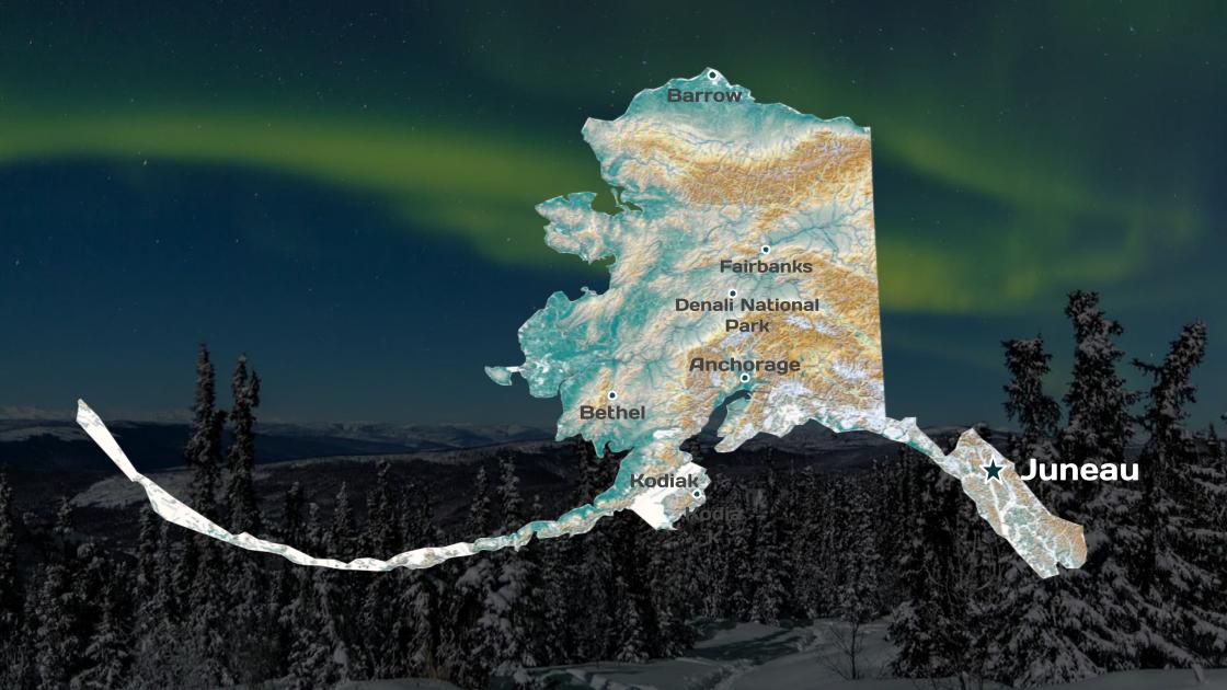
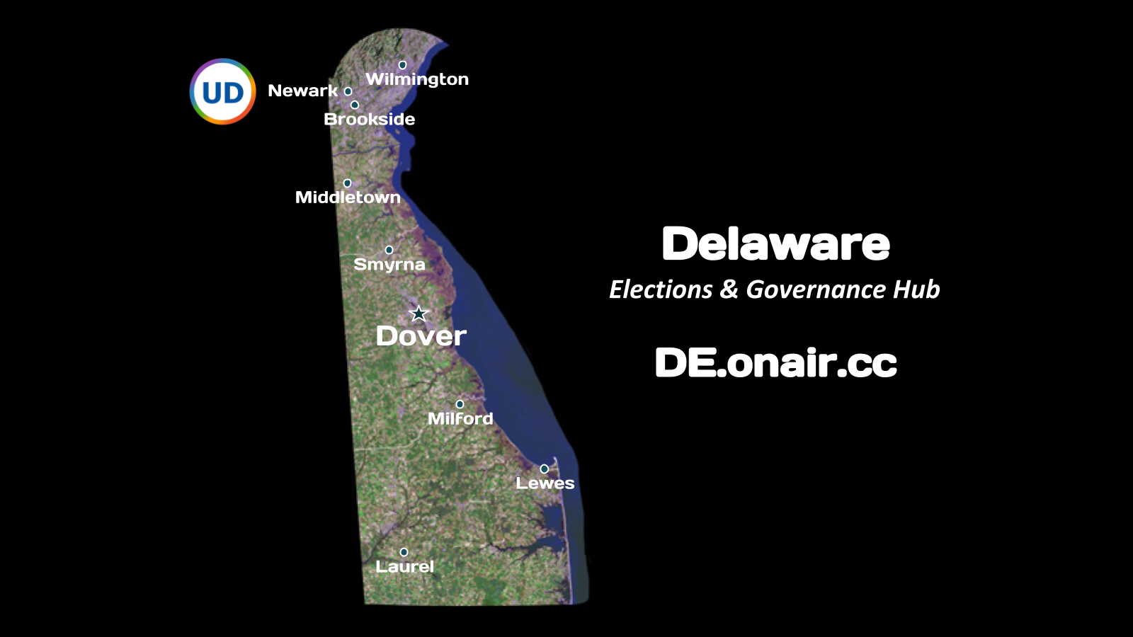
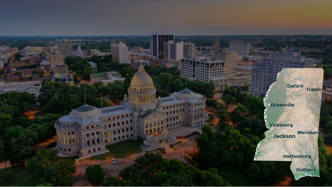
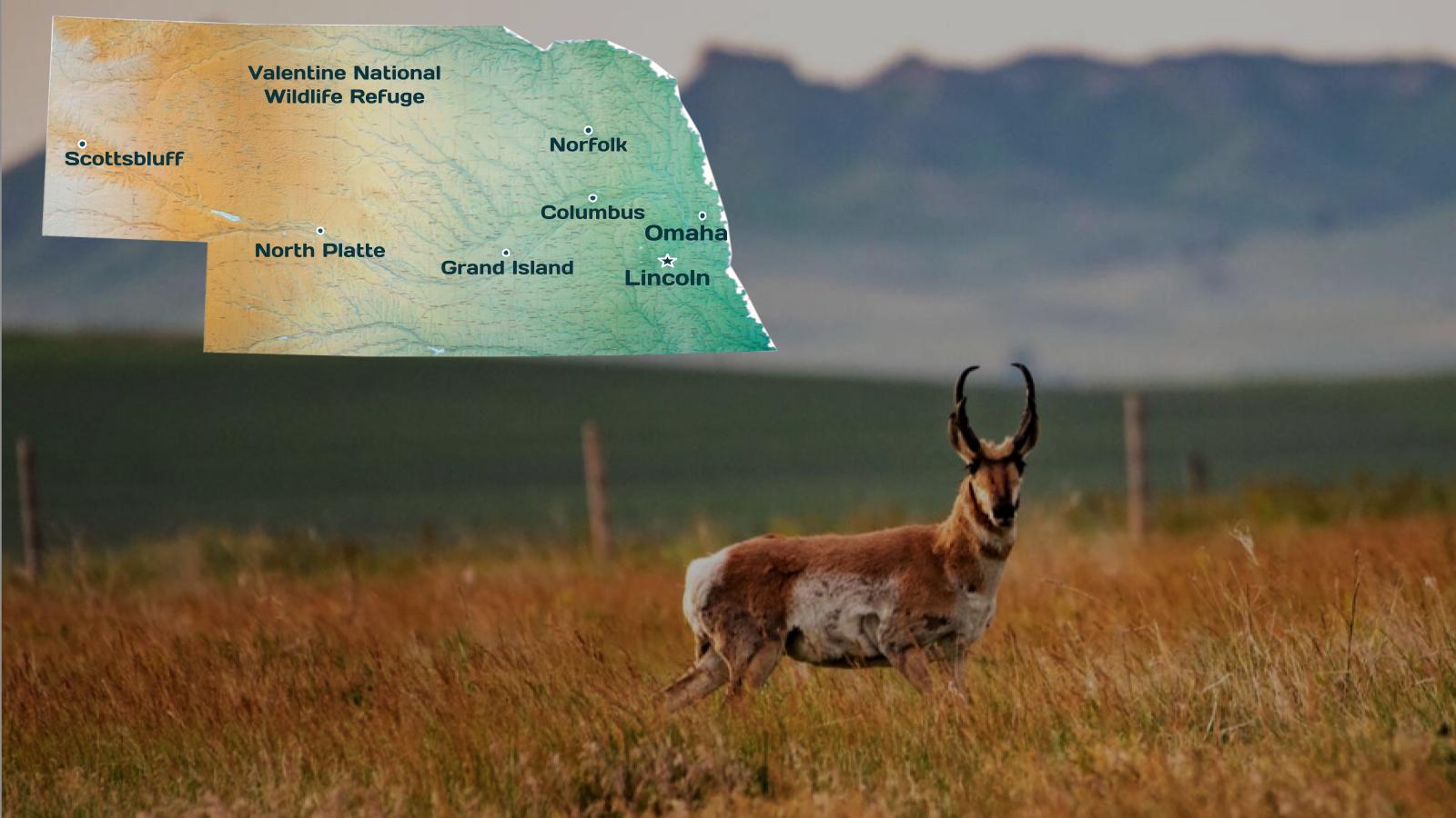
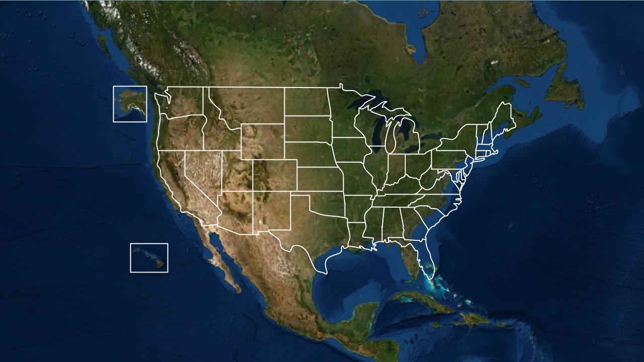
The United States of America (U.S.A. or USA), commonly known as the United States (U.S. or US) or America, is a transcontinental country primarily located in North America. It consists of 50 states, a federal district, five major unincorporated territories, nine minor outlying islands, and 326 Indian reservations with limited sovereignty. It is the third-largest country by both land and total area.

The United States shares land borders with Canada to the north and with Mexico to the south as well as maritime borders with the Bahamas, Cuba, and Russia, among others. With more than 331 million people, it is the third most populous country in the world.

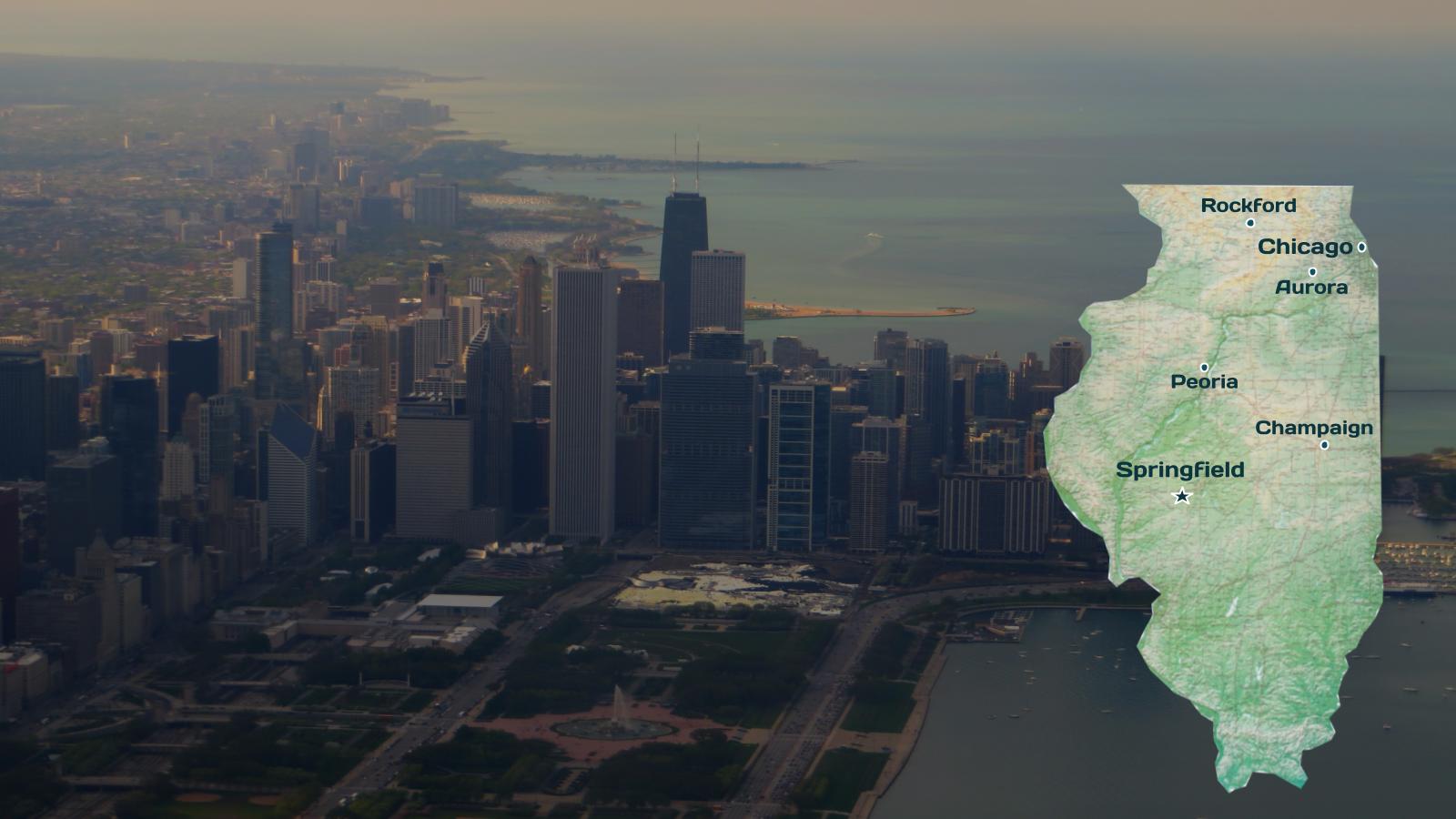
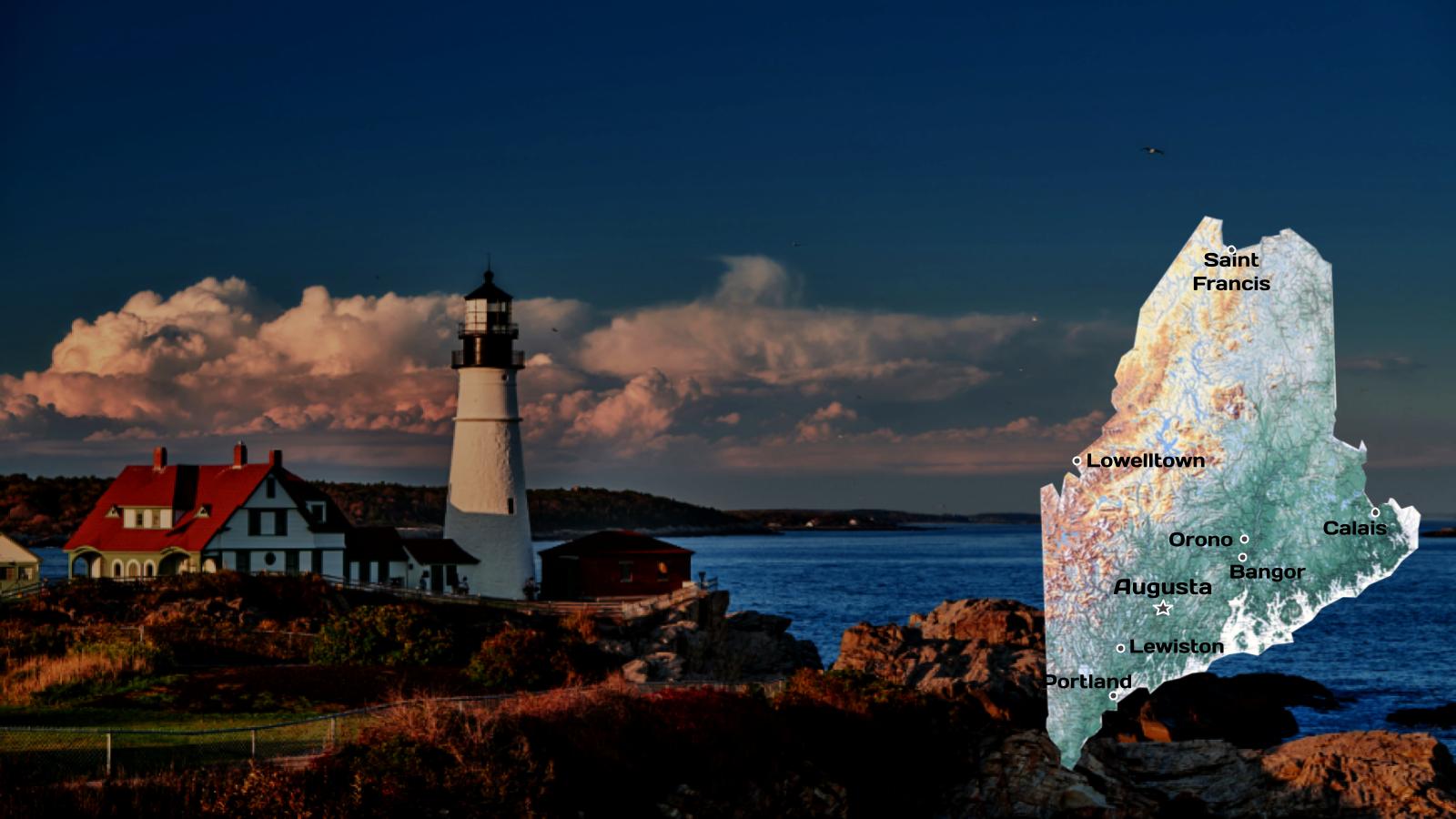
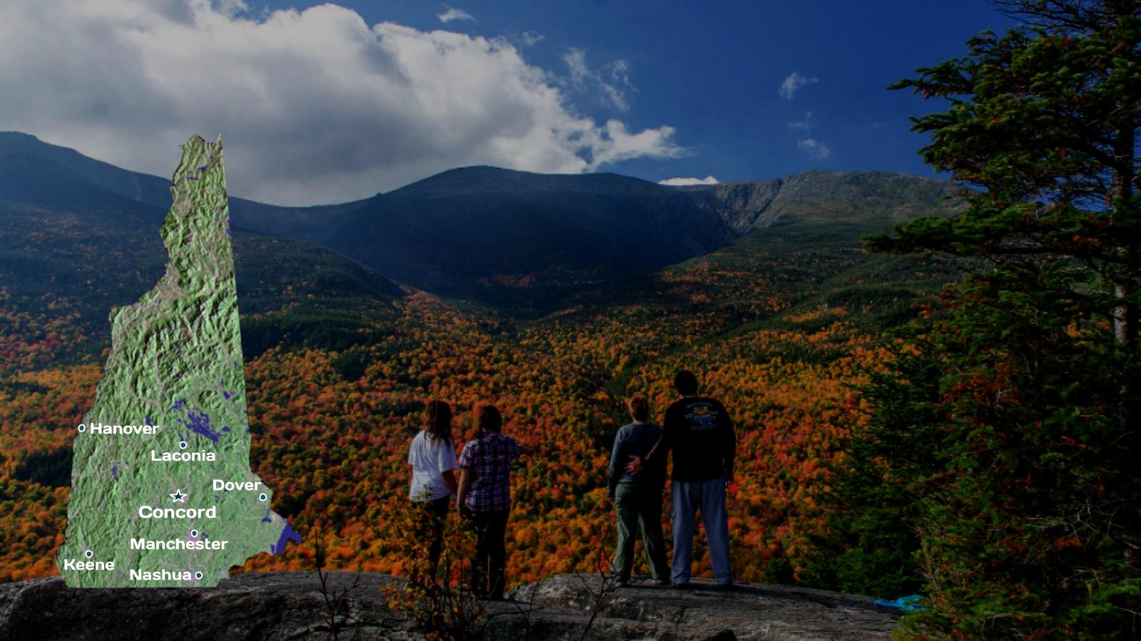
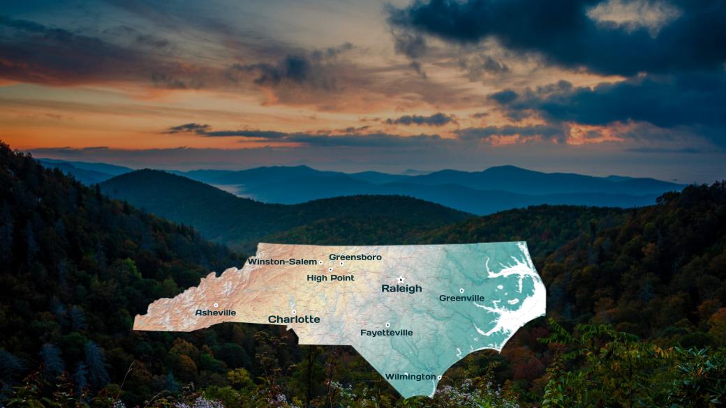
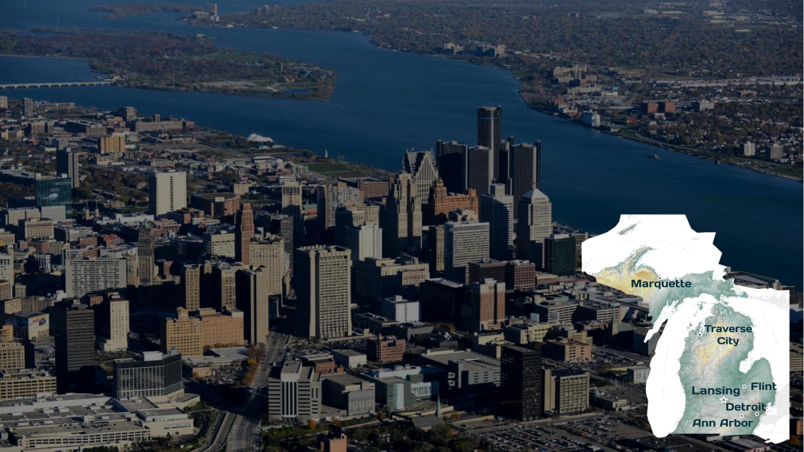
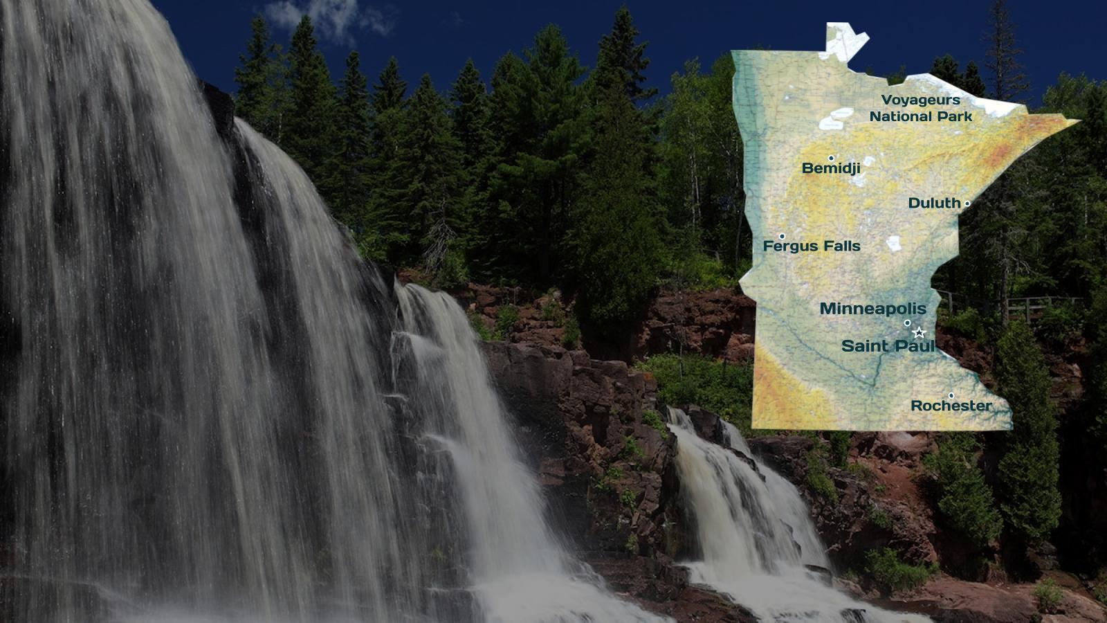
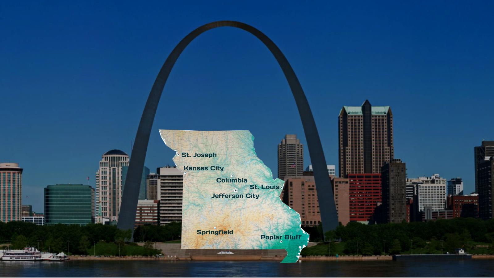
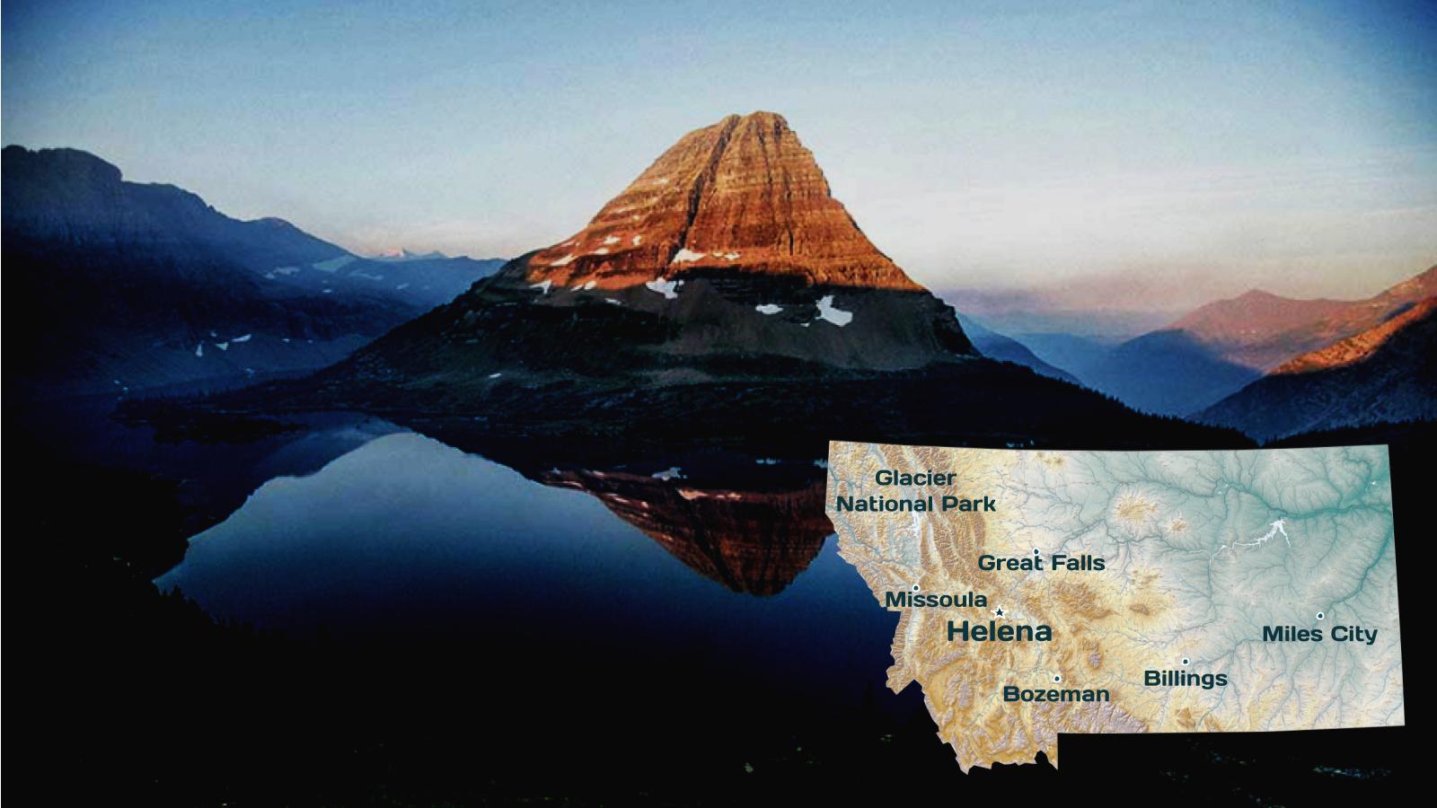
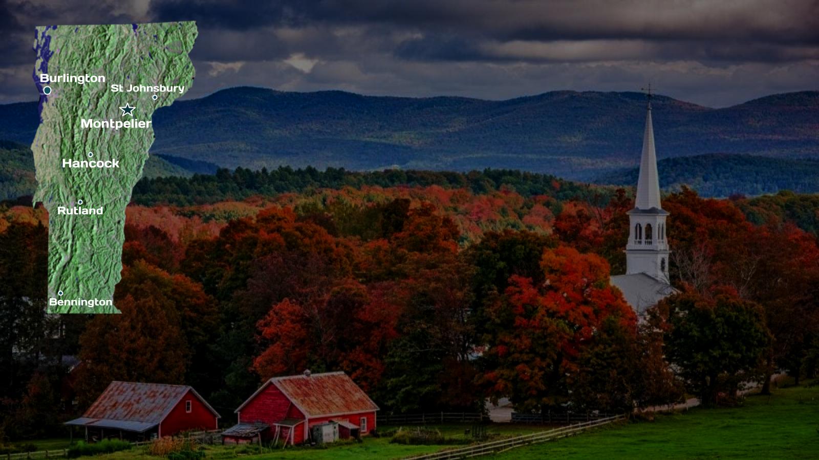
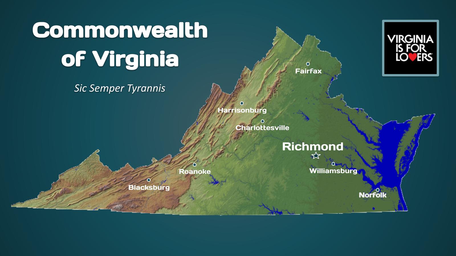
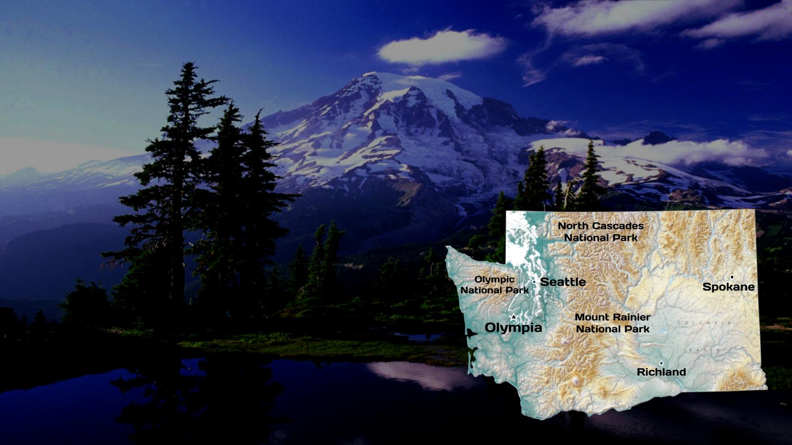
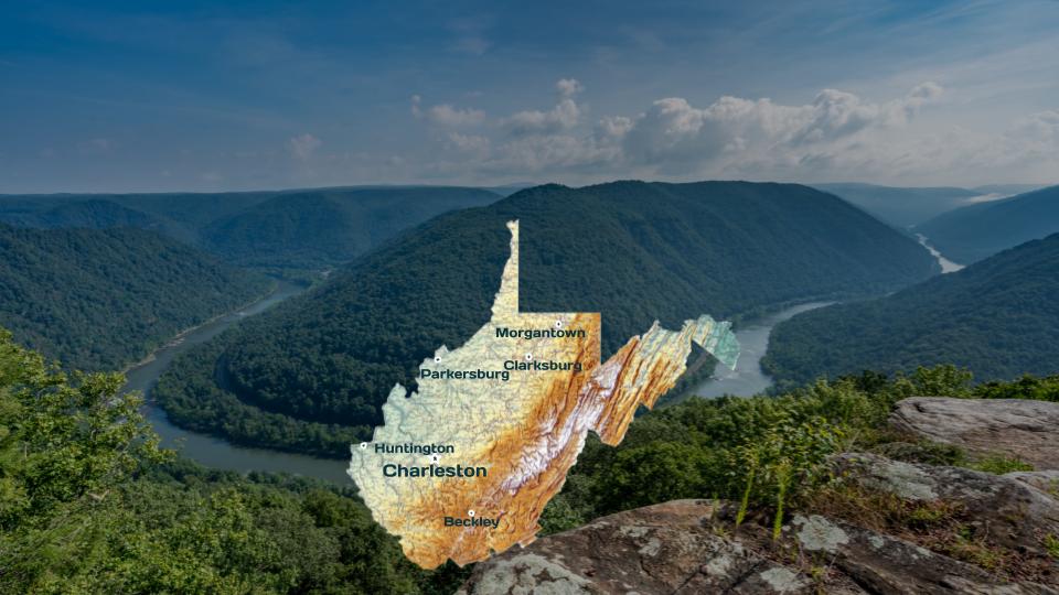
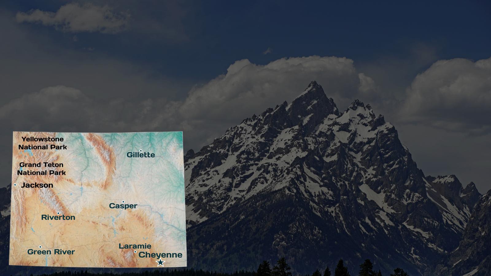
The national capital is Washington, D.C., and the most populous city and financial center is New York City. The United States is known for its highly diverse climate and geography, encompassing landscapes that range from polar to tropical, arid to humid, and is officially recognized as one of the 17 megadiverse countries.

OnAir Post: About the United States

About Alabama

Alabama is a state in the Southeastern region of the United States, bordered by Tennessee to the north; Georgia to the east; Florida and the Gulf of Mexico to the south; and Mississippi to the west. Alabama is the 30th largest by area and the 24th-most populous of the U.S. states. With a total of 1,500 miles (2,400 km) of inland waterways, Alabama has among the most of any state.

The state’s geography is diverse, with the north dominated by the mountainous Tennessee Valley and the south by Mobile Bay, a historically significant port. Politically, as part of the Deep South, Alabama is now a predominantly conservative state, and it is known for its Southern culture. Today, American football, particularly at the college level at schools like the University of Alabama, Auburn University, Alabama A&M University, Alabama State University and Jacksonville State University is a major part of the state’s culture.

Government Website    Wikipedia page

OnAir Post: About Alabama

About Arizona

Arizona is a state in the Western United States, grouped in the Southwestern and occasionally Mountain subregions. It is the 6th largest and the 14th most populous of the 50 states. Its capital and largest city is Phoenix. Arizona shares the Four Corners region with Utah to the north, Colorado to the northeast, and New Mexico to the east; its other neighboring states are Nevada and California to the west and the Mexican states of Sonora and Baja California to the south and southwest.

Since the 1950s, Arizona’s population and economy have grown dramatically because of migration into the state, and now the state is a major hub of the Sun Belt. Cities such as Phoenix and Tucson have developed large, sprawling suburban areas. Many large companies, such as PetSmart and CircleK, have headquarters in the state, and Arizona is home to major universities, including the University of Arizona and Arizona State University. Traditionally, the state is politically known for national conservative figures such as Barry Goldwater and John McCain, though it voted Democratic in the 1996 presidential race and in the 2020 presidential and senatorial elections.

OnAir Post: About Arizona

About California

California is a state in the Western United States. It is bordered by Nevada to the east, Arizona to the southeast, the Pacific Ocean to the west, Oregon to the north, and the Mexican state of Baja California to the south. With over 39.5 million residents across a total area of approximately 163,696 square miles (423,970 km2), it is the most populous and the third-largest U.S. state by area. It is also the most populated subnational entity in North America and the 34th most populous in the world. The Greater Los Angeles area and the San Francisco Bay Area are the nation’s second and fifth most populous urban regions respectively, with the former having more than 18.7 million residents and the latter having over 9.6 million.

Sacramento is the state’s capital, while Los Angeles is the most populous city in the state and the second most populous city in the country (after New York City). Los Angeles County is the country’s most populous, while San Bernardino County is the largest county by area in the country. San Francisco, which is both a city and county, is the second most densely populated major city in the country (after New York City) and the fifth most densely populated county in the country, behind four of New York City’s five boroughs.

Government Website    Wikipedia page

OnAir Post: About California

About Florida

Florida is a state in the Southeastern region of the United States, bordered to the west by the Gulf of Mexico; Alabama to the northwest; Georgia to the north; the Bahamas and Atlantic Ocean to the east; and the Straits of Florida and Cuba to the south. It is the only state that borders both the Gulf of Mexico and the Atlantic Ocean. With a population exceeding 21 million, it is the third-most populous state in the nation and ranks eighth in population density as of 2020.

It spans 65,758 square miles (170,310 km2), ranking 22nd in area among the 50 states. The Miami metropolitan area, anchored by the cities of Miami, Fort Lauderdale, and West Palm Beach, is the state’s largest metropolitan area with a population of 6.138 million, and the state’s most-populous city is Jacksonville with a population of 949,611. Florida’s other major population centers include Tampa Bay, Orlando, Cape Coral, and the state capital of Tallahassee.

OnAir Post: About Florida

About Georgia

Georgia is a state in the Southeastern region of the United States, bordered to the north by Tennessee and North Carolina; to the northeast by South Carolina; to the southeast by the Atlantic Ocean; to the south by Florida; and to the west by Alabama. Georgia is the 24th-largest in area and 8th-most populous of the 50 United States. Its 2020 population was 10,711,908, according to the U.S. Census Bureau.[5] Atlanta, a “beta(+)” global city, is both the state’s capital and its largest city. The Atlanta metropolitan area, with an estimated population of more than 6 million people in 2019, is the 9th most populous metropolitan area in the United States and contains about 57% of Georgia’s entire population.

Government Website    Wikipedia page

OnAir Post: About Georgia

About Illinois

Illinois is a state in the Midwestern region of the United States. It has the fifth largest gross domestic product (GDP), the sixth largest population, and the 25th largest land area of all U.S. states. Illinois has been noted as a microcosm of the entire United States.

With Chicago in northeastern Illinois, small industrial cities and immense agricultural productivity in the north and center of the state, and natural resources such as coal, timber, and petroleum in the south, Illinois has a diverse economic base, and is a major transportation hub. The Port of Chicago connects the state to international ports via two main routes: from the Great Lakes, via the Saint Lawrence Seaway, to the Atlantic Ocean and from the Great Lakes to the Mississippi River, via the Illinois River, through the Illinois Waterway. The Mississippi River, the Ohio River, and the Wabash River form parts of the boundaries of Illinois. For decades, Chicago’s O’Hare International Airport has been ranked as one of the world’s busiest airports. Illinois has long had a reputation as a bellwether both in social and cultural terms[7] and, through the 1980s, in politics.

Government Website    Wikipedia page

OnAir Post: About Illinois

About Maine

Maine is a state in the New England region of the United States, bordered by New Hampshire to the west; the Atlantic Ocean to the southeast; and the Canadian provinces of New Brunswick and Quebec to the northeast and northwest, respectively. Maine is the 12th-smallest by area, the 9th-least populous, and the 13th-least densely populated of the 50 U.S. states. It is also the northeasternmost among the contiguous United States, the northernmost state east of the Great Lakes, the only state whose name consists of a single syllable, and the only state to border only one other state. Maine is known for its jagged, rocky coastline; low, rolling mountains; heavily forested interior; picturesque waterways; and its seafood cuisine, especially lobster and clams. There is a humid continental climate throughout most of the state, including coastal areas. Its most populous city is Portland, and its capital is Augusta.

Government Website    Wikipedia page

OnAir Post: About Maine

About New Hampshire

New Hampshire  is a state in the New England region of the United States. It is bordered by Massachusetts to the south, Vermont to the west, Maine and the Atlantic Ocean to the east, and the Canadian province of Quebec to the north. New Hampshire is the 5th smallest by area and the 10th least populous U.S. state. Concord is the state capital, while Manchester is the largest city.

New Hampshire has no general sales tax, nor income tax other than on interest and dividends. The New Hampshire primary is the first primary in the U.S. presidential election cycle. Its license plates carry the state motto, “Live Free or Die”. The state’s nickname, “The Granite State”, refers to its extensive granite formations and quarries.

Government Website    Wikipedia page

OnAir Post: About New Hampshire

About North Carolina

North Carolina is a state in the Southeastern region of the United States. North Carolina is the 28th largest and 9th-most populous of the 50 United States. It is bordered by Virginia to the north, the Atlantic Ocean to the east, Georgia and South Carolina to the south, and Tennessee to the west. Raleigh is the state’s capital and Charlotte is its largest city.

The Charlotte metropolitan area, with an estimated population of 2,569,213 in 2018, is the most-populous metropolitan area in North Carolina, the 23rd-most populous in the United States, and the largest banking center in the nation after New York City. The Raleigh-Durham-Cary combined statistical area is the second-largest metropolitan area in the state, with an estimated population of 2,079,687 in 2019, and is home to the largest research park in the United States, Research Triangle Park.

Government Website    Wikipedia page

OnAir Post: About North Carolina

About Tennessee

Tennessee, officially the State of Tennessee, is a state in the Southeastern region of the United States. Tennessee is the 36th largest by area and the 16th most populous of the 50 states. It is bordered by Kentucky to the north, Virginia to the northeast, North Carolina to the east, Georgia, Alabama, and Mississippi to the south, Arkansas to the southwest, and Missouri to the northwest. Tennessee is geographically, culturally, and legally divided into three Grand Divisions of East, Middle, and West Tennessee. Nashville is the state’s capital and largest city, and anchors its largest metropolitan area. Tennessee’s population as of the 2020 United States census is approximately 6.9 million.

Government Website    Wikipedia page

OnAir Post: About Tennessee

About Texas

Texas is a state in the South Central region of the United States. It is the second largest U.S. state by both area (after Alaska) and population (after California). Texas shares borders with the states of Louisiana to the east, Arkansas to the northeast, Oklahoma to the north, New Mexico to the west, and the Mexican states of Chihuahua, Coahuila, Nuevo León, and Tamaulipas to the south and southwest, and has a coastline with the Gulf of Mexico to the southeast.

Houston is the most populous city in Texas and the fourth largest in the U.S., while San Antonio is the second-most populous in the state and seventh largest in the U.S. Dallas–Fort Worth and Greater Houston are the fourth and fifth largest metropolitan statistical areas in the country, respectively. Other major cities include Austin, the second-most populous state capital in the U.S., and El Paso. Texas is nicknamed the “Lone Star State” for its former status as an independent republic, and as a reminder of the state’s struggle for independence from Mexico. The “Lone Star” can be found on the Texas state flag and on the Texas state seal.] The origin of Texas’s name is from the Caddo word táyshaʼ meaning ‘friends’.

Government Website    Wikipedia page  

OnAir Post: About Texas

About Arkansas

Arkansas is a state in the South Central region of the United States, home to more than three million people as of 2018. Its name is from the Osage language, a Dhegiha Siouan language, and referred to their relatives, the Quapaw people. The state’s diverse geography ranges from the mountainous regions of the Ozark and Ouachita Mountains, which make up the U.S. Interior Highlands, to the densely forested land in the south known as the Arkansas Timberlands, to the eastern lowlands along the Mississippi River and the Arkansas Delta.

Government Website    Wikipedia page

OnAir Post: About Arkansas

About Colorado

Colorado is a state in the Mountain West subregion of the Western United States. It encompasses most of the Southern Rocky Mountains as well as the northeastern portion of the Colorado Plateau and the western edge of the Great Plains. Colorado is the eighth most extensive and 21st most populous U.S. state. The 2020 United States Census enumerated the population of Colorado at 5,773,714, an increase of 14.80% since the 2010 United States Census.

Colorado is bordered by Wyoming to the north, Nebraska to the northeast, Kansas to the east, Oklahoma to the southeast, New Mexico to the south, Utah to the west, and touches Arizona to the southwest at the Four Corners. Colorado is noted for its vivid landscape of mountains, forests, high plains, mesas, canyons, plateaus, rivers, and desert lands. Colorado is one of the Mountain States and is a part of the western and southwestern United States.

Denver is the capital and most populous city in Colorado. Residents of the state are known as Coloradans, although the antiquated “Coloradoan” is occasionally used. Colorado is a comparatively wealthy state, ranking eighth in household income in 2016, and 11th in per capita income in 2010. Major parts of the economy include government and defense, mining, agriculture, tourism, and increasingly other kinds of manufacturing. With increasing temperatures and decreasing water availability, Colorado’s agriculture, forestry and tourism economies are expected to be heavily affected by climate change.

OnAir Post: About Colorado

About Connecticut

Connecticut is the southernmost state in the New England region of the United States. As of the 2010 Census, it has the highest per-capita income, second-highest level of human development behind Massachusetts, and highest median household income in the United States. It is bordered by Rhode Island to the east, Massachusetts to the north, New York to the west, and the Long Island Sound to the south. Its capital is Hartford and its most populous city is Bridgeport. Historically the state is part of New England as well as the tri-state area with New York and New Jersey, which together make up metropolitan New York City.

Connecticut is the third smallest state by area, the 29th most populous, and the fourth most densely populated of the fifty states. It is known as the “Constitution State”, the “Nutmeg State”, the “Provisions State”, and the “Land of Steady Habits”. It was influential in the development of the federal government of the United States (see Connecticut Compromise). The Connecticut River, Thames River, and ports along Long Island Sound have given Connecticut a strong maritime tradition which continues today. The state also has a long history of hosting the financial services industry, including insurance companies in Hartford and hedge funds in Fairfield County.

Government Website    Wikipedia page 

OnAir Post: About Connecticut

About Idaho

Idaho is a state in the Pacific Northwest region of the United States. It borders the state of Montana to the east and northeast, Wyoming to the east, Nevada and Utah to the south, and Washington and Oregon to the west. To the north, it shares a small portion of the Canadian border with the province of British Columbia.

With a population of approximately 1.8 million and an area of 83,570 square miles (216,400 km2), Idaho is the 14th largest, the 13th least populous and the 7th least densely populated of the 50 U.S. states. The state’s capital and largest city is Boise.

OnAir Post: About Idaho

About Indiana

Indiana is a U.S. state in the Midwestern United States. It is the 38th-largest by area and the 17th-most populous of the 50 United States. Its capital and largest city is Indianapolis. Indiana was admitted to the United States as the 19th state on December 11, 1816. It is bordered by Lake Michigan to the northwest, Michigan to the north, Ohio to the east, the Ohio River and Kentucky to the south and southeast, and the Wabash River and Illinois to the west.

Government Website    Wikipedia page 

OnAir Post: About Indiana

About Iowa

Iowa is a state in the Midwestern region of the United States, bordered by the Mississippi River to the east and the Missouri River and Big Sioux River to the west. It is bordered by six states: Wisconsin to the northeast, Illinois to the east and southeast, Missouri to the south, Nebraska to the west, South Dakota to the northwest, and Minnesota to the north.

Iowa is the 26th most extensive in total area and the 31st most populous of the 50 U.S. states with a population of 3,190,369 according to the 2020 census. The state’s capital, most populous city, and largest metropolitan area fully located within the state is Des Moines. A portion of the larger Omaha, Nebraska, metropolitan area extends into three counties of southwest Iowa.  Iowa has been listed as one of the safest U.S. states to live in.

Government Website    Wikipedia page

OnAir Post: About Iowa

About Kansas

Kansas is a state in the Midwestern United States. Its capital is Topeka and its largest city is Wichita. Kansas is bordered by Nebraska to the north; Missouri to the east; Oklahoma to the south; and Colorado to the west. Kansas is named after the Kansas River, which in turn was named after the Kansa Native Americans who lived along its banks. The tribe’s name (natively kką:ze) is often said to mean “people of the (south) wind” although this was probably not the term’s original meaning. For thousands of years, what is now Kansas was home to numerous and diverse Native American tribes. Tribes in the eastern part of the state generally lived in villages along the river valleys. Tribes in the western part of the state were semi-nomadic and hunted large herds of bison.

Government Website    Wikipedia page

OnAir Post: About Kansas

About Kentucky

Kentucky officially the Commonwealth of Kentucky, is a state in the Upland South region of the United States, bordered by Illinois, Indiana, and Ohio to the north; West Virginia and Virginia to the east; Tennessee to the south; and Missouri to the west. The bluegrass region in the central part of the commonwealth contains the commonwealth’s capital, Frankfort, as well as its two largest cities, Louisville and Lexington. Together they comprise more than 20% of the commonwealth’s population. Kentucky is the 37th most extensive and the 26th most populous of the 50 United States.

Government Website    Wikipedia page

OnAir Post: About Kentucky

About Louisiana

Louisiana is a state in the Deep South and South Central regions of the United States. It is the 19th-smallest by area and the 25th most populous of the 50 U.S. states. Louisiana is bordered by the state of Texas to the west, Arkansas to the north, Mississippi to the east, and the Gulf of Mexico to the south. A large part of its eastern boundary is demarcated by the Mississippi River. Louisiana is the only U.S. state with political subdivisions termed parishes, which are equivalent to counties, making it one of only two U.S. states not subdivided into counties (the other being Alaska). The state’s capital is Baton Rouge, and its largest city is New Orleans.

Government Website    Wikipedia page

OnAir Post: About Louisiana

About Massachusetts

Massachusetts is the most populous state in the New England region of the United States. It borders on the Atlantic Ocean to the east, Connecticut to the southwest and Rhode Island to the southeast, New Hampshire to the northeast, Vermont to the northwest, and New York to the west. The capital of Massachusetts is Boston, which is also the most populous city in New England. It is home to the Greater Boston metropolitan area, a region influential upon American history, academia, and industry.

Originally dependent on agriculture, fishing and trade,[47] Massachusetts was transformed into a manufacturing center during the Industrial Revolution.[48] During the 20th century, Massachusetts’s economy shifted from manufacturing to services. Modern Massachusetts is a global leader in biotechnology, engineering, higher education, finance, and maritime trade.

Government Website   Wikipedia page

OnAir Post: About Massachusetts

About Michigan

Michigan is a state in the Great Lakes region of the upper Midwestern United States. Its name derives from a gallicized variant of the original Ojibwe word ᒥᓯᑲᒥ (mishigami),[7] meaning “large water” or “large lake.” With a population of nearly 10.1 million and a total area of nearly 97,000 sq mi, Michigan is the 10th-largest state by population, the 11th-largest by area, and the largest east of the Mississippi River.[b] Its capital is Lansing, and its largest city is Detroit. Metro Detroit is among the nation’s most populous and largest metropolitan economies.

Michigan is the only state to consist of two peninsulas. The Lower Peninsula is shaped like a mitten. The Upper Peninsula (often called “the U.P.”) is separated from the Lower Peninsula by the Straits of Mackinac, a five-mile (8 km) channel that joins Lake Huron to Lake Michigan. The Mackinac Bridge connects the peninsulas. Michigan has the longest freshwater coastline of any political subdivision in the world, being bordered by four of the five Great Lakes, plus Lake St. Clair.[9] It also has 64,980 inland lakes and ponds.[10]

Government Website    Wikipedia page 

OnAir Post: About Michigan

About Minnesota

Minnesota is a state in the upper Midwestern United States. It is the 12th largest U.S. state in area and the 22nd most populous, with over 5.7 million residents. More than half of Minnesotans live in the Minneapolis–Saint Paul metropolitan area, known as the “Twin Cities”, which is the main political, economic, and cultural hub.[8] Greater Minneapolis is among the 20 largest metropolises in the U.S. Other Minnesota metropolitan areas include Duluth, Mankato, Moorhead, Rochester and St. Cloud.[9] Minnesota’s geography is highly diverse, consisting of western prairies, now given over to intensive agriculture; deciduous forests in the southeast, now partially cleared, farmed, and settled; and the less populated North Woods, used for mining, forestry, and recreation. Roughly a third of the state is forested, and it is known as the “Land of 10,000 Lakes” for having over 11,800 bodies of fresh water that are at least ten acres.

Government Website    Wikipedia page 

OnAir Post: About Minnesota

About Missouri

Missouri is a state in the Midwestern region of the United States.[6] With more than six million residents, it is the 19th-most populous state of the country. The largest urban areas are St. Louis, Kansas City, Springfield and Columbia; the capital is Jefferson City. The state is the 21st-most extensive in area. Missouri is bordered by eight states (tied for the most with Tennessee): Iowa to the north, Illinois, Kentucky and Tennessee (via the Mississippi River) to the east, Arkansas to the south and Oklahoma, Kansas and Nebraska to the west. In the south are the Ozarks, a forested highland, providing timber, minerals, and recreation. The Missouri River, after which the state is named, flows through the center of the state into the Mississippi River, which makes up Missouri’s eastern border.

Government Website    Wikipedia page 

OnAir Post: About Missouri

About Montana

Montana is a state in the Mountain West subregion of the Western United States. It is bordered by Idaho to the west; North Dakota and South Dakota to the east; Wyoming to the south; and by the Canadian provinces of Alberta, British Columbia, and Saskatchewan to the north.

It is the fourth-largest state by area, the seventh-least populous state, and the third-least densely populated state. The western half of Montana contains numerous mountain ranges, while the eastern half is characterized by western prairie terrain and badlands, with more (albeit smaller) mountain ranges found throughout the state. In all, 77 named ranges are part of the Rocky Mountains.

OnAir Post: About Montana

About New Jersey

New Jersey is a state in the Mid-Atlantic and Northeastern regions of the United States. It is bordered on the north and east by the state of New York; on the east, southeast, and south by the Atlantic Ocean; on the west by the Delaware River and Pennsylvania; and on the southwest by Delaware Bay and the state of Delaware. New Jersey is the fourth-smallest state by area but the 11th-most populous, with 9,288,994 residents as of 2020 and an area of 8,722.58 square miles (22,591.4 km2), making it the most densely populated of the 50 U.S. states. New Jersey’s state capital is Trenton, while the state’s most populous city is Newark. All but one county in New Jersey (Warren County)[10] lie within the combined statistical areas of New York City or Philadelphia; consequently, the state’s largest metropolitan area falls within Greater New York.

Government Website    Wikipedia page

OnAir Post: About New Jersey

About New Mexico

New Mexico is a state in the Southwestern United States; its capital is Santa Fe, which was founded in 1610 as capital of Nuevo México (itself established as a province of New Spain in 1598), while its largest city is Albuquerque with its accompanying metropolitan area. It is one of the Mountain States of the Southern Rocky Mountains, and shares the Four Corners region of the Western U.S. with Utah, Colorado, and Arizona. New Mexico is also bordered by the state of Texas to the east-southeast, Oklahoma to the northeast, and the Mexican states of Chihuahua to the south and Sonora to the southwest.

With a population of 2,120,220 as of the 2020 U.S. Census, New Mexico is the 36th largest state by population. With a total area of 121,590 sq mi (314,900 km2), it is the fifth-largest and sixth-least densely populated of the 50 states. Due to their geographic locations, northern and eastern New Mexico exhibit a colder alpine climate, while western and southern New Mexico exhibit a warmer arid climate; the Rio Grande and its fertile valley runs from north-to-south creating a riperian climate in the middle of the state, supplying central New Mexico with its bosque (gallery forest) and distinct Albuquerque Basin climate.

OnAir Post: About New Mexico

About New York

New York is a state in the Mid-Atlantic and Northeastern regions of the United States. It was one of the original thirteen colonies forming the United States. With a total area of 54,556 square miles (141,300 km2), New York is the 27th largest state; its population of more than 20 million people in 2020 makes it the fourth most populous state in the U.S.

The state is bordered by New Jersey and Pennsylvania to the south and Connecticut, Massachusetts, and Vermont to the east; it has a maritime border with Rhode Island, east of Long Island, as well as an international border with the Canadian provinces of Quebec to the north and Ontario to the northwest. It is sometimes referred to as New York State to distinguish it from New York City, which is its largest city.

Government Website    Wikipedia page

OnAir Post: About New York

About North Dakota

North Dakota is a U.S. state in the upper Midwestern United States. It is named after the Lakota and Dakota Sioux Native American tribes, who comprise a large portion of the population and historically dominated the territory. It is the nineteenth largest in area, the fourth least populous, and the fourth most sparsely populated of the 50 states with a population of 779,094 according to the 2020 census. Its capital is Bismarck, and its largest city is Fargo.

North Dakota was admitted to the Union on November 2, 1889, along with its neighboring state, South Dakota. They were the 39th and 40th states admitted to the union. President Benjamin Harrison shuffled the statehood papers before signing them so that no one could tell which became a state first. For convenience, the two states are officially numbered in alphabetical order. In the 21st century, North Dakota’s natural resources have played a major role in its economic performance, particularly with the oil extraction from the Bakken formation, which lies beneath the northwestern part of the state. Such development has led to population growth and reduced unemployment, resulting in North Dakota’s having the second lowest unemployment rate in the nation (after Hawaii). North Dakota is home to the tallest man-made structure in the Western Hemisphere, the KVLY-TV mast.

Government Website   Wikipedia page 

OnAir Post: About North Dakota

About Ohio

Ohio (/oʊˈhaɪoʊ/ (is a state in the Midwestern region of the United States. Of the fifty states, it is the 34th-largest by area, and with a population of just over 11.8 million, is the seventh-most populous and tenth-most densely populated. The state’s capital and largest city is Columbus, with the Columbus metro area, Greater Cincinnati, and Greater Cleveland being the largest metropolitan areas. Ohio is bordered by Lake Erie to the north, Pennsylvania to the east, West Virginia to the southeast, Kentucky to the southwest, Indiana to the west, and Michigan to the northwest. Ohio is historically known as the “Buckeye State” after its Ohio buckeye trees, and Ohioans are also known as “Buckeyes”. Its state flag is the only non-rectangular flag of all the U.S. states.

Government Website    Wikipedia page 

OnAir Post: About Ohio

About Oklahoma

Oklahoma  is a state in the South Central region of the United States,[27] bordered by the state of Texas on the south and west, Kansas on the north, Missouri on the northeast, Arkansas on the east, New Mexico on the west, and Colorado on the northwest. Partially in the western extreme of the Upland South, it is the 20th-most extensive and the 28th-most populous of the 50 United States. Its residents are known as Oklahomans (or colloquially “Okies”), and its capital and largest city is Oklahoma City.

Government Website    Wikipedia page

OnAir Post: About Oklahoma

About Oregon

Oregon is a state in the Pacific Northwest region of the Western United States. The Columbia River delineates much of Oregon’s northern boundary with Washington, while the Snake River delineates much of its eastern boundary with Idaho. The 42° north parallel delineates the southern boundary with California and Nevada.

Because of its diverse landscapes and waterways, Oregon’s economy is largely powered by various forms of agriculture, fishing, and hydroelectric power. Oregon is also the top lumber producer of the contiguous United States, with the lumber industry dominating the state’s economy during the 20th century. Technology is another one of Oregon’s major economic forces, beginning in the 1970s with the establishment of the Silicon Forest and the expansion of Tektronix and Intel. Sportswear company Nike, Inc., headquartered in Beaverton, is the state’s largest public corporation with an annual revenue of $30.6 billion.

Government Website    Wikipedia page

OnAir Post: About Oregon

About South Dakota

South Dakota is a U.S. state in the upper Midwestern United States. It is named after the Lakota and Dakota Sioux Native American tribes, who comprise a large portion of the population and historically dominated the territory. South Dakota is the seventeenth largest by area, but the 5th least populous, and the 5th least densely populated of the 50 United States.

As the southern part of the former Dakota Territory, South Dakota became a state on November 2, 1889, simultaneously with North Dakota. It is either the 39th or 40th state admitted to the union. President Benjamin Harrison shuffled the statehood papers before signing them so that no one could tell which became a state first.[10] Pierre is the state capital, and Sioux Falls, with a population of about 187,200, is South Dakota’s largest city.

Government Website    Wikipedia page

OnAir Post: About South Dakota

About Alaska

Alaska is a U.S. state in the Western United States, on the northwest extremity of the country’s west coast. A semi-exclave of the U.S., it borders the Canadian province of British Columbia and territory of Yukon to the east and has a maritime border with Russia’s Chukotka Autonomous Okrug to the west, just across the Bering Strait. To the north are the Chukchi and Beaufort seas of the Arctic Ocean, while the Pacific Ocean lies to the south and southwest.

Alaska is by far the largest U.S. state by area, comprising more total area than the next three largest states Texas, California, and Montana combined, and the seventh largest subnational division in the world.  Approximately half of Alaska’s residents live within the Anchorage metropolitan area. The state capital of Juneau is the second-largest city in the United States by area, comprising more territory than the states of Rhode Island and Delaware.

Government Website   Wikipedia page

OnAir Post: About Alaska

About Delaware

Delaware is a state in the Mid-Atlantic region of the United States. It borders Maryland to its south and west, Pennsylvania to its north, New Jersey to its northeast, and the Atlantic Ocean to its east. The state’s name derives from the adjacent Delaware Bay, which in turn was named after Thomas West, 3rd Baron De La Warr, an English nobleman and the Colony of Virginia’s first colonial-era governor.

Delaware occupies the northeastern portion of the Delmarva Peninsula, and some islands and territory within the Delaware River. It is the 2nd smallest and 6th least populous state, but also the 6th most densely populated. Delaware’s most populous city is Wilmington, and the state’s capital is Dover, the 2nd most populous city in Delaware. The state is divided into three counties, the fewest number of counties of any of the 50 U.S. states;[b] from north to south, the three counties are: New Castle County, Kent County, and Sussex County.

OnAir Post: About Delaware

About Hawaii

Hawaii is a U.S. state in the Western United States, in the Pacific Ocean about 2,000 miles (3,200 km) from the U.S. mainland. It is the only state outside North America, the only state composed entirely of islands, and the only state in the tropics. Hawaii is also one of a few U.S. states to have once been an independent nation.

Of the 50 U.S. states, Hawaii is the eighth-smallest in area and the 11th-least populous, but the 13th-most densely populated, with 1.4 million residents. Two-thirds of the population lives on O’ahu, home to the state’s capital and largest city, Honolulu. Hawaii is among the country’s most diverse states, owing to its central location in the Pacific and over two centuries of migration; it has the nation’s only Asian American plurality, largest Buddhist community, and largest proportion of multiracial people. Consequently, it is a unique melting pot of Southeast Asian, East Asian and North American cultures, in addition to its indigenous Hawaiian culture.

Government Website    Wikipedia page

OnAir Post: About Hawaii

About Mississippi

Mississippi (/ˌmɪsɪˈsɪpi/ ( listen)) is a state in the Southeastern region of the United States, bordered to the north by Tennessee; to the east by Alabama; to the south by the Gulf of Mexico; to the southwest by Louisiana; and to the northwest by Arkansas. Mississippi’s western boundary is largely defined by the Mississippi River. Mississippi is the 32nd largest and 34th-most populous of the 50 U.S. states. Jackson is both the state’s capital and largest city. Greater Jackson is the state’s most populous metropolitan area, with an estimated population of 580,166 in 2018.

Government Website    Wikipedia page

OnAir Post: About Mississippi

About Nebraska

Nebraska is a state in the Midwestern region of the United States. It is bordered by South Dakota to the north; Iowa to the east and Missouri to the southeast, both across the Missouri River; Kansas to the south; Colorado to the southwest; and Wyoming to the west. It is the only triply landlocked U.S. state.

Nebraska’s area is just over 77,220 square miles (200,000 km2) with a population of over 1.9 million. Its capital is Lincoln, and its largest city is Omaha, which is on the Missouri River.

Government Website    Wikipedia page 

OnAir Post: About Nebraska

About Nevada

Nevada is a state in the Western region of the United States.  It is bordered by Oregon to the northwest, Idaho to the northeast, California to the west, Arizona to the southeast, and Utah to the east. Nevada is the 7th-most extensive, the 19th-least populous, and the 9th-least densely populated of the U.S. states. Nearly three-quarters of Nevada’s people live in Clark County, which contains the Las Vegas–Paradise metropolitan area, including three of the state’s four largest incorporated cities. Nevada’s capital is Carson City.

Nevada has a reputation for its libertarian laws. In 1940, with a population of just over 110,000 people, Nevada was by far the least-populated state, with less than half the population of the next least-populous state, Wyoming. However, legalized gambling and lenient marriage and divorce laws transformed Nevada into a major tourist destination in the 20th century. Nevada is the only U.S. state where prostitution is legal, though it is illegal in its most populated regions – Clark County (Las Vegas), Washoe County (Reno) and Carson City (which, as an independent city, is not within the boundaries of any county). The tourism industry remains Nevada’s largest employer, with mining continuing as a substantial sector of the economy: Nevada is the fourth-largest producer of gold in the world.

OnAir Post: About Nevada

About Pennsylvania

Pennsylvania, officially the Commonwealth of Pennsylvania, is a state in the Mid-Atlantic, Northeastern, and Appalachian regions of the United States. The Commonwealth is bordered by Delaware to the southeast, Maryland to the south, West Virginia to the southwest, Ohio to the west, Lake Erie and the Canadian province of Ontario to the northwest, New York to the north, and New Jersey to the east, while the Appalachian Mountains run through its middle.

Pennsylvania is the 33rd-largest state by area, and the 5th-most populous state with a total population of 13,011,844 according to the most recent official U.S. Census count in 2020. It is the 9th-most densely populated of the 50 states. Pennsylvania’s two most populous cities are Philadelphia (1,580,863), and Pittsburgh (302,407). The state capital and its 13th-largest city is Harrisburg. Pennsylvania has 140 miles (225 km) of waterfront along Lake Erie and the Delaware River.

Government Website    Wikipedia page

OnAir Post: About Pennsylvania

About Rhode Island

Rhode Island officially the State of Rhode Island, is a state in the New England region of the United States. It is the smallest U.S. state by area and the seventh-least populous (1,098,163 according to the 2020 census), but it is also the second-most densely populated behind New Jersey.

The state takes its name from Rhode Island; however, most of the state is on the mainland. The state has land borders with Connecticut to the west, Massachusetts to the north and east, and the Atlantic Ocean to the south via Rhode Island Sound and Block Island Sound. It also shares a small maritime border with New York. Providence is the state capital and most populous city in Rhode Island.

Government Website    Wikipedia page

OnAir Post: About Rhode Island

About South Carolina

South Carolina is a state in the Southeastern region of the United States. It is bordered to the north by North Carolina, to the southeast by the Atlantic Ocean, and to the southwest by Georgia across the Savannah River. South Carolina is the 40th most extensive and 23rd most populous U.S. state with a recorded population of 5,124,712[ according to the 2020 census. In 2019, its GDP was $213.45 billion. South Carolina is composed of 46 counties. The capital is Columbia with a population of 133,273 in 2019; while its largest city is Charleston with a 2019 population of 135,257.[9] The Greenville–Anderson–Mauldin metropolitan area is the largest in the state, with a 2018 population estimate of 906,626.

Government Website    Wikipedia page

OnAir Post: About South Carolina

About Utah

Utah is a state in the Mountain West subregion of the Western United States. It is bordered by Colorado to the east, Wyoming to the northeast, Idaho to the north, Arizona to the south and Nevada to the west. It also touches a corner of New Mexico in the southeast. Of the fifty U.S. states, Utah is the 13th-largest by area; with a population over three million, it is the 30th-most-populous and 11th-least-densely populated. Urban development is mostly concentrated in two areas: the Wasatch Front in the north-central part of the state, which is home to roughly two-thirds of the population and includes the capital city, Salt Lake City; and Washington County in the south, with more than 170,000 residents.[9] Most of the western half of Utah lies in the Great Basin.

Utah has a highly diversified economy, with major sectors including transportation, education, information technology and research, government services, mining; it is also a major tourist destination for outdoor recreation. In 2013, the U.S. Census Bureau estimated that Utah had the second-fastest-growing population of any state.  St. George was the fastest-growing metropolitan area in the United States from 2000 to 2005. Utah also has the 14th-highest median average income and the least income inequality of any U.S. state. A 2012 Gallup national survey found Utah overall to be the “best state to live in the future” based on 13 forward-looking measurements including various economic, lifestyle, and health-related outlook metrics.

OnAir Post: About Utah

About Vermont

Vermont is a state in the New England region of the United States. It borders the states of Massachusetts to the south, New Hampshire to the east, and New York to the west, and the Canadian province of Quebec to the north. Vermont is the only state in New England that does not border the Atlantic Ocean. Vermont is the second-least-populated U.S. state and the sixth-smallest by area of the 50 U.S. states with a recorded population of 643,503 according to the 2020 U.S. census. The state capital is Montpelier, the least-populous state capital in the United States. The most-populous city, Burlington, is the least-populous city to be the most-populous city in a state.

Government Website    Wikipedia page

OnAir Post: About Vermont

About Virginia

Virginia, officially the Commonwealth of Virginia, is a state in the Mid-Atlantic and Southeastern regions of the United States,[5][6] between the Atlantic Coast and the Appalachian Mountains. The geography and climate of the Commonwealth are shaped by the Blue Ridge Mountains and the Chesapeake Bay, which provide habitat for much of its flora and fauna.

The capital of the Commonwealth is Richmond; Virginia Beach is the most-populous city, and Fairfax County is the most-populous political subdivision. The Commonwealth’s population in 2020 was over 8.65 million, with 36% of them living in the Baltimore–Washington metropolitan area.

OnAir Post: About Virginia

About Washington

Washington officially the State of Washington, is a state in the Pacific Northwest region of the Western United States. Named for George Washington, the first U.S. president, the state was made out of the western part of the Washington Territory, which was ceded by the British Empire in 1846, in accordance with the Oregon Treaty in the settlement of the Oregon boundary dispute. The state, which is bordered on the west by the Pacific Ocean, Oregon to the south, Idaho to the east, and the Canadian province of British Columbia to the north, was admitted to the Union as the 42nd state in 1889. Olympia is the state capital; the state’s largest city is Seattle.

Government Website    Wikipedia page

OnAir Post: About Washington

About West Virginia

West Virginia (/vərˈdʒɪn.jə/ ( listen)) is a state in the Appalachian, Mid-Atlantic and Southeastern regions of the United States.[Note 1] It is bordered by Pennsylvania to the northeast, Maryland to the east and northeast, Virginia to the southeast, Kentucky to the southwest, and Ohio to the northwest. West Virginia is the 41st-largest state by area and ranks 39th in population, with a population of 1,795,045 residents.[7] The capital and largest city is Charleston.

The state is noted for its mountains and rolling hills, its historically significant coal mining and logging industries, and its political and labor history. It is also known for a wide range of outdoor recreational opportunities, including skiing, whitewater rafting, fishing, hiking, backpacking, mountain biking, rock climbing, and hunting.

Government Website    Wikipedia page  

OnAir Post: About West Virginia

About Wisconsin

Wisconsin (/wɪˈskɒnsɪn/ ( listen)) is a state in the upper Midwestern United States, bordered by Minnesota to the west; Iowa to the southwest; Illinois to the south; Lake Michigan to the east; Michigan to the northeast; and Lake Superior to the north. Wisconsin is the 23rd-largest state by total area and the 20th-most populous.

Milwaukee, its largest city, sits on the western shore of Lake Michigan. The state capital, Madison, is currently the second most populated and fastest growing city in the state.[11] Green Bay and Kenosha, the third and fourth most populated Wisconsin cities respectively, also sit on the western shores of Lake Michigan. The state is divided into 72 counties.

Government Website    Wikipedia page 

OnAir Post: About Wisconsin

About Wyoming

Wyoming is a state in the Mountain West subregion of the Western United States. The 10th largest state by area, it is also the least populous, and the least densely populated state in the contiguous United States.

It is bordered by Montana to the north and northwest, South Dakota and Nebraska to the east, Idaho to the west, Utah to the southwest, and Colorado to the south.

The state population was 576,851 at the 2020 U.S. census. The state capital and the most populous city is Cheyenne, which had an estimated population of 64,235 in 2019.

OnAir Post: About Wyoming

About Maryland

Maryland is a state in the Mid-Atlantic region of the United States, bordering Virginia, West Virginia, and the District of Columbia to its south and west; Pennsylvania to its north; and Delaware and the Atlantic Ocean to its east. Baltimore is the largest city in the state and the capital is Annapolis. Among its occasional nicknames are Old Line State, the Free State, and the Chesapeake Bay State. It is named after the English Queen Henrietta Maria, known in England as Queen Mary, who was the wife of King Charles.

Sixteen of Maryland’s twenty-three counties, as well as the city of Baltimore, border the tidal waters of the Chesapeake Bay estuary and its many tributaries,[21][11] which combined total more than 4,000 miles of shoreline. Although one of the smallest states in the U.S., it features a variety of climates and topographical features that have earned it the moniker of America in Miniature.[22] In a similar vein, Maryland’s geography, culture, and history combine elements of the Mid-Atlantic, Northeastern, and Southern regions of the country.

Government Website    Wikipedia page 

OnAir Post: About Maryland

Skip to toolbar